Historical and practical context
Eritrea: Asmara, history and geography for planning
Eritrea lies in the Horn of Africa, with Asmara as its capital and main point of reference. This practical guide covers history, geography, languages, currency and transport to help you plan—and highlights what to verify.
A trip to Eritrea starts with the essentials: Asmara, the capital in the Horn of Africa, and a country that was a province of Ethiopia from 1962 to 1993 before becoming a state. Publicly available information can help you understand its geography, languages and currency, but it is no substitute for checking flights, permits and services. For travellers, the best approach is to take time to understand the destination: use its historical context, coordinates, language and currency as a compass, not as a promise of a ready-made itinerary.
Asmara, the capital that anchors a visit
The most reliable starting point for planning a visit is Asmara, Eritrea’s capital and the centre of the Maekel region. Geographic data place the city at around 15.34° N and 38.93° E, with a recorded population of 563,930. For travellers, this means the capital concentrates most of the urban infrastructure and services that can be checked in advance. However, the existence of a city does not guarantee transport, accommodation or medical care; confirm routes, schedules and availability before booking. Asmara is a starting point, not a complete itinerary.
A brief history to understand the present
Before making plans, it helps to remember that Eritrea was a province of Ethiopia from 1962 to 1993 and that the Eritrean state was established in 1993. This history helps explain why different sources may use different names, maps and administrative frameworks for the country. For travellers, historical context is not an embellishment: it helps make sense of documents, maps and conversations. It is also a reminder that services can change quickly, so check dates, permits and connections when booking. History offers perspective, but it cannot replace up-to-date practical information.
Geography of the Horn of Africa
Eritrea is in East Africa, within the Horn of Africa and the wider region of Sub-Saharan Africa. The country is not landlocked: its coastline places it by the sea, although the available evidence does not specify beaches, ports or coastal routes. When planning, distinguish general geography from specific services: a coastline exists, but that does not mean it is accessible, safe or equipped for tourism. Asmara’s coordinates and the Maekel region provide a practical anchor; information about the rest of the country should be checked against current sources.
Languages and currency: two practical essentials
The languages listed for Eritrea are Arabic, English and Tigrinya. English may be useful as a bridge in formal settings, but it does not guarantee that you will be understood in every neighbourhood, market or rural area. The currency is the Eritrean nakfa, symbol Nfk. Knowing the currency helps you understand prices and plan for cash, but exchange rates, fees and prices should not be guessed. Before setting out, check card acceptance, cash availability and currency-exchange rules with official sources or your service provider.
Transport and checks before booking
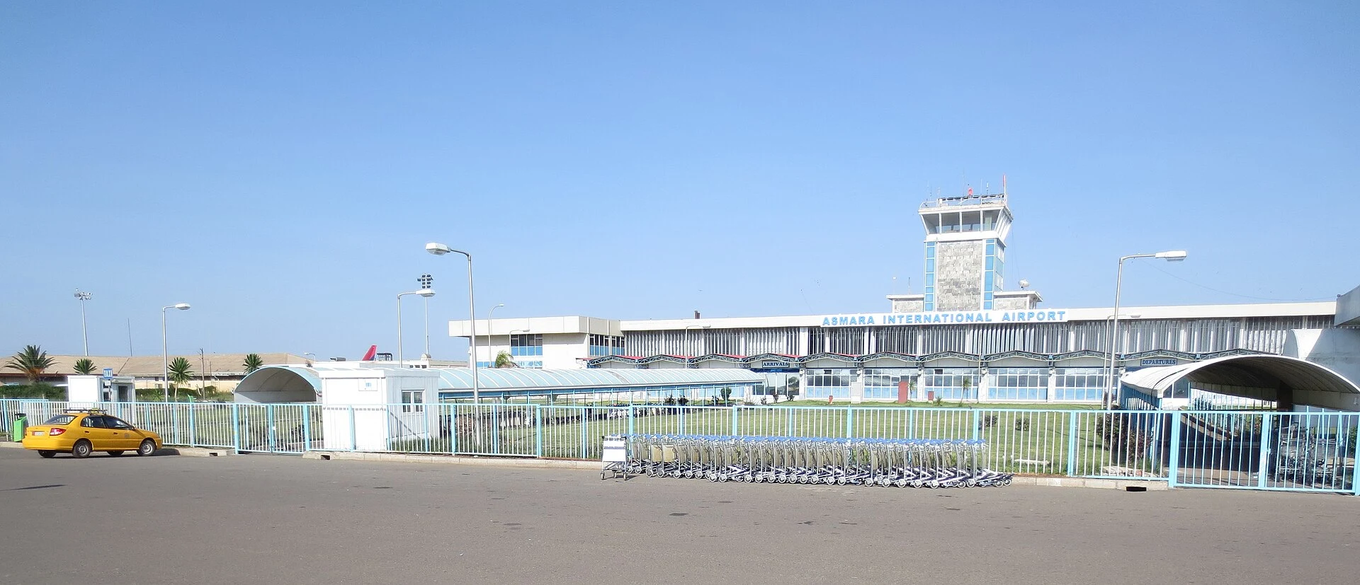
The main airport reference is Asmara International Airport, with IATA code ASM and ICAO code HHAS. The available data identify the airfield but do not confirm current flights, airlines, schedules or fares. The practical rule is simple: do not buy tickets or build an itinerary without checking what is operating now. Confirm routes, connections, entry requirements and baggage conditions directly with the airline or an authorised operator. A trip to Eritrea should be based on verification, not assumptions.
References consulted during editorial review. Times, requirements and advisories may change: always confirm with the official source.
- Eritrea WikidataCC0 1.0 Wikidata · Q986
- Eritrea WikidataCC0 1.0 Wikidata · Q14645015
- Eritrea WikidataCC0 1.0 Wikidata · Q1354899
- Eritrea World Countries — mledozeODbL 1.0 World countries dataset by mledoze and contributors · ODbL 1.0
- Asmara GeoNamesDatos geográficos bajo CC BY 4.0; requiere atribución a GeoNames. Fuente: GeoNames
- Asmara, Maekel Region, Eritrea OpenStreetMapODbL 1.0; atribución y obligación de compartir bases derivadas. Fuente: OpenStreetMap
- Eritrea World Bank Open DataCC BY 4.0 World Bank
- Eritrea DBpediaCC BY-SA 3.0 DBpedia
- Asmara International Airport OpenFlightsODbL 1.0 (base de datos) / DbCL 1.0 (contenidos) Asmara International Airport · OpenFlights · ODbL 1.0
- Asmara WikidataCC0 1.0 Wikidata · Q3642
- Maekel Region WikidataCC0 1.0 Wikidata · Q27710