Canada by Regions: Scale, Distances, and Travel Decisions
Canada comprises distinct regions and vast distances that make covering the entire country in a single trip unrealistic. Choosing a specific zone and verifying how to connect within it is a better starting point than planning on a national scale.
A documented soundscape that complements this guide to Canada. Canada comprises distinct regions and vast distances that make covering the entire country in a single trip unrealistic. Choosing a specific zone and verifying how to connect within it is a better starting point than planning on a national scale.
Audio by Hamilton, Edward; Rogers, Walter B.; Beck, O. F.; Werrenrath, Reinald · loc_national_jukebox · Public Domain · Duration: 02:39
The region matters more than the national map
The tourist division into regions helps narrow down the trip: Atlantic Provinces, Quebec, Ontario, the Prairies, British Columbia, and the North. These are not interchangeable zones: the Prairies include Alberta, Saskatchewan, and Manitoba, while Yukon, the Northwest Territories, and Nunavut form the North. Scale conditions the plan: attempting to link distant regions can consume the time intended for exploring them. First define the landscape or urban environment you seek, then research travel within that zone.
One name, very different landscapes
The Prairies are not just grasslands: the region includes cities, lakes, hills, forests, and parts of the Rocky Mountains. In the North, however, boreal, subarctic, and Arctic environments coexist, with large sparsely populated spaces. This diversity prevents extrapolating a local experience to the entire country. Choose by contrast or affinity: a city and its surroundings offer a different travel logic than a remote region or a route centered on natural landscapes.
The train: an experience, not a universal solution
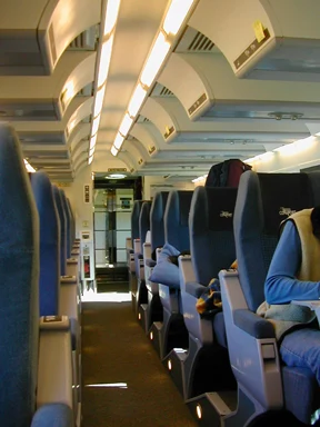
The train can be attractive due to the space and the journey, but it does not equate to a fast network covering the whole country. Available information describes long-distance services as slow compared to air travel and, outside urban cores, subject to delays; it also notes that track priority usually corresponds to freight transport. The transcontinental route consists of several segments. Verify the exact route —operation, duration, schedules, and price— before making it the axis of the trip: these data can change.
In the North, logistics are part of the destination
Distances and low population density mean that access varies greatly from place to place. Some communities are connected by road, but in areas without roads, access may depend on air travel or seasonal water links. Some parks cited in the North require charter flights or specialized expeditions, not a simple stop from a city. Do not assume a point on the map is accessible: verify current options directly for the specific location and allow time to resolve connections.
How to move from region to a verifiable plan
Once the zone is chosen, list the localities you actually want to visit and estimate the distances between them using updated information. If you consider the train, review the service for the planned dates; if the plan includes remote spaces, confirm how to get there and which operator or transport is necessary. Ottawa, Toronto, Montreal, Vancouver, and territorial capitals appear as geographic references, but mentioning them does not imply they form a practical route between each other. The itinerary must follow real logistics, not the compact appearance of a map.
Sources and references
Hide references
14 references
References consulted during editorial review. Times, requirements and advisories may change: always confirm with the official source.
-
Northern CanadaLicence: CC BY-SA 4.0 Wikivoyage contributors · Northern Canada
-
Rail travel in CanadaLicence: CC BY-SA 4.0 Wikivoyage contributors · Rail travel in Canada
-
Canadá - WikiviajesLicence: CC BY-SA 4.0 Wikivoyage contributors · Canadá - Wikiviajes
-
Praderas (Canadá) - WikiviajesLicence: CC BY-SA 4.0 Wikivoyage contributors · Praderas (Canadá) - Wikiviajes
-
Trans-Canadá - WikiviajesLicence: CC BY-SA 4.0 Wikivoyage contributors · Trans-Canadá - Wikiviajes
-
CanadaLicence: CC BY-SA 4.0 Fuente: Wikivoyage
-
Canadian national parksLicence: CC BY-SA 4.0 Fuente: Wikivoyage
-
Parques nacionales de CanadáLicence: CC BY-SA 4.0 Fuente: Wikivoyage
-
OntarioLicence: CC BY-SA 4.0 Fuente: Wikivoyage
-
OttawaLicence: CC BY-SA 4.0 Fuente: Wikivoyage