Ghat, Libya: Tuareg history and references for travel decisions
Ghat was a key point on trans-Saharan routes and a stronghold of the Kel Ajjer Tuareg confederation. Its history helps understand the place, but current travel conditions require independent verification.
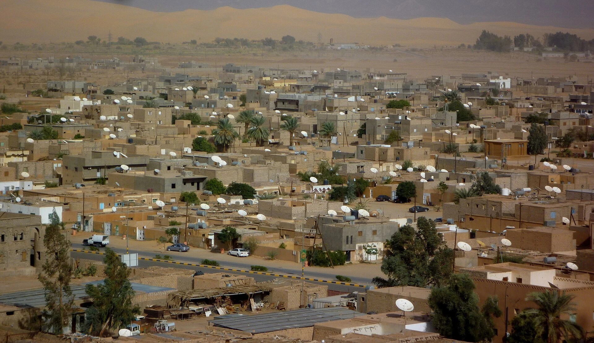
A waypoint in trans-Saharan networks
In historical periods, Ghat was a prominent terminal of the trans-Saharan trade route and a bastion of the Kel Ajjer federation. The historical relationship of this entity covered southwestern Libya and areas of southeastern Algeria. This regional scale helps understand Ghat as part of Saharan connections, not as an isolated enclave. The source consulted does not detail specific goods, historical itineraries, or current community practices, so it is not advisable to fill those gaps with assumptions.
Occupations, fortress, and independence
The city was occupied by Italy in 1913; Italian control was reinforced from 1923. On the Koukemen hill, the Italians completed a fortress whose construction had been initiated by the Ottomans at the beginning of the 20th century. Ghat was occupied by French forces from 1943 until January 1, 1952, a date linked to a UN General Assembly resolution establishing that Libya should become independent. These data describe historical episodes; they do not inform on the current state of the fortress or its access.
The documented attraction and the practical limit
The guide consulted presents the Ghat fortress as a tourist destination and mentions the proximity of Tadrart Acacus and the Tassili N'Ajjer mountains, associated with prehistoric paintings and engravings and desert landscapes. But the same national source, updated in October 2026, describes a highly unstable political environment and notes that many governments advise against traveling to Libya. This warning takes priority over any tourist description: check your country's official recommendation and the specific situation before considering travel. Guide data do not confirm current availability, access, or safety.
What to check before making plans
The Wikivoyage information consulted in 2023 described the Ghat airport as located about 20 km from the center and recorded a route to Tripoli. This is a dated reference, not evidence of current flights. Do not use this data to book connections or plan transfers: verify directly with official sources and current operators, in addition to reviewing travel alerts. The source also indicates that places outside the town may require 4x4 vehicles; it does not confirm current road conditions, availability of vehicles, or permits. For a first national orientation, also consult the Libya guide on geography, Tripoli, and data to verify.
Sources and references
Hide references
14 references
References consulted during editorial review. Times, requirements and advisories may change: always confirm with the official source.
-
Ghat (Libya)Licence: CC BY-SA 4.0 Wikivoyage contributors · Ghat (Libya)
-
LibyaLicence: CC BY-SA 4.0 Wikivoyage contributors · Libya
-
Bayda (Libya)Licence: CC BY-SA 4.0 Wikivoyage contributors · Bayda (Libya)
-
Al Jawf (Libya)Licence: CC BY-SA 4.0 Wikivoyage contributors · Al Jawf (Libya)
-
Chad - WikiviajesLicence: CC BY-SA 4.0 Wikivoyage contributors · Chad - Wikiviajes
-
Argelia - WikiviajesLicence: CC BY-SA 4.0 Wikivoyage contributors · Argelia - Wikiviajes
-
Libia - WikiviajesLicence: CC BY-SA 4.0 Wikivoyage contributors · Libia - Wikiviajes
-
Níger - WikiviajesLicence: CC BY-SA 4.0 Wikivoyage contributors · Níger - Wikiviajes
-
LibyaLicence: CC BY-SA 3.0 DBpedia
-
Kingdom of LibyaLicence: CC BY-SA 3.0 DBpedia