Kondoa and Rock Art Amid the Plateaus of Central Tanzania
Central Tanzania brings together plateaus, savannah and cultivated land. Kondoa offers a clear reason to stop: its painted rock shelters, set within an archaeological and cultural landscape shaped by a long history.
An inland landscape of plateaus and dry savannah
Much of the central region lies on the East African Plateau. Its landscape combines grasslands, dry savannah, wooded areas and cultivated land. The climate tends to be drier than on the humid coast, though conditions vary by location and elevation. Dodoma serves as a political centre, while towns such as Singida and Tabora help convey the region’s breadth. The source describes the area as a link between Tanzania’s coast and its western and northern regions, but provides no routes or connections that would turn this general orientation into a transport plan.
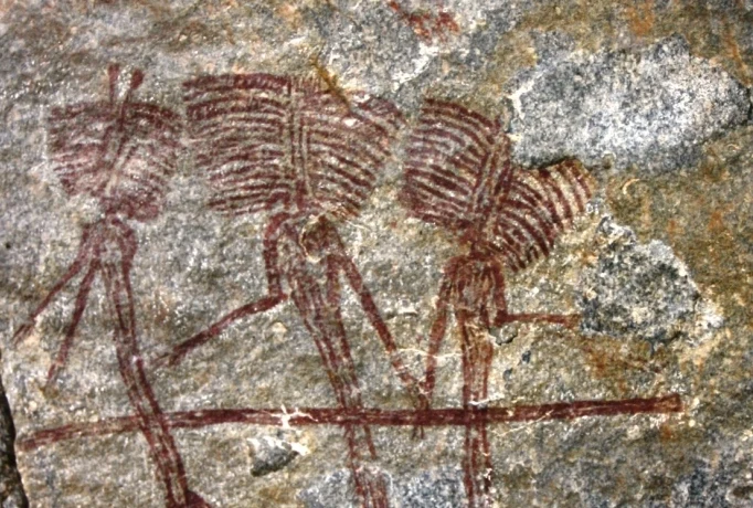
Kondoa and its painted rock shelters
Kondoa, in the Dodoma Region, is known as a gateway to the Kondoa rock-art sites: rock shelters with prehistoric paintings that form an archaeological and cultural landscape of regional importance. The connection between the images and their setting gives a visit a different focus from an ordinary town stop: the main attraction is heritage embedded in the landscape. The available evidence does not specify which shelters can be visited, how to reach them or whether guided visits are available. Before planning a day there, check current local information on access, route conditions and conservation rules.
Deciding what this stop can offer
Kondoa is a better fit for a trip centred on history and landscape than for one focused solely on major urban centres. The region also has national parks and savannah areas, but the information gathered is not enough to recommend a specific combination, estimate travel times or compare alternatives. First decide whether the rock art is a priority, then verify the practical arrangements from your chosen starting point. For broader context on the country, see this guide to Tanzania’s geography.
Sources and references
Hide references
14 references
References consulted during editorial review. Times, requirements and advisories may change: always confirm with the official source.
-
Central TanzaniaLicence: CC BY-SA 4.0 Wikivoyage contributors · Central Tanzania
-
Northeast TanzaniaLicence: CC BY-SA 4.0 Wikivoyage contributors · Northeast Tanzania
-
Northwest TanzaniaLicence: CC BY-SA 4.0 Wikivoyage contributors · Northwest Tanzania
-
TanzaniaLicence: CC BY-SA 4.0 Wikivoyage contributors · Tanzania
-
Burundi - WikiviajesLicence: CC BY-SA 4.0 Wikivoyage contributors · Burundi - Wikiviajes
-
Mozambique - WikiviajesLicence: CC BY-SA 4.0 Wikivoyage contributors · Mozambique - Wikiviajes
-
Tanzania - WikiviajesLicence: CC BY-SA 4.0 Wikivoyage contributors · Tanzania - Wikiviajes
-
Zambia - WikiviajesLicence: CC BY-SA 4.0 Wikivoyage contributors · Zambia - Wikiviajes
-
Arusha National ParkLicence: CC BY-SA 4.0 Fuente: Wikivoyage
-
KondoaLicence: CC BY-SA 4.0 Fuente: Wikivoyage
-
DodomaLicence: Datos geográficos bajo CC BY 4.0; requiere atribución a GeoNames. Fuente: GeoNames