Nepal by region: cities, valleys and mountain routes
From the historic squares of the Kathmandu Valley to Himalayan trekking routes, Nepal offers very different kinds of trips. Altitude can help you decide what to combine and what to check before setting out.
The Kathmandu Valley: heritage in an urban setting
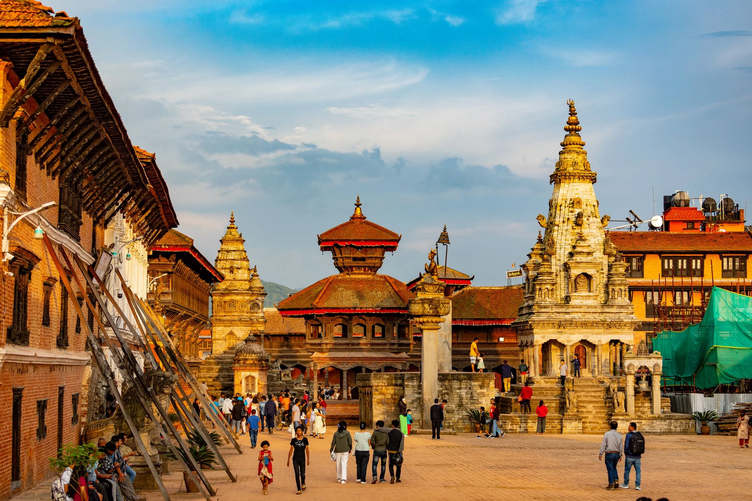
Kathmandu is a useful base for exploring the valley, which also includes Patan and Bhaktapur. The capital is home to places such as Hanuman Dhoka Durbar Square and the stupas of Boudhanath and Swayambhunath; Patan and Bhaktapur have their own historic and monumental centres. Bhaktapur is also known for its pottery and as a pilgrimage destination. It is a strong choice if you prioritise architecture, history and urban life over a mountain trek. For a closer look at a day in the city, see our walking route through Bhaktapur.
The mid-hills and Terai: a different scale of travel
South of the Himalaya, the mid-hills form a region of valleys and uplands that reaches roughly 4,000 metres in regional descriptions. The outer Terai, by contrast, is a belt of plains. Lumbini, associated with the birth of Gautama Buddha, offers a religious and historical reason to travel that differs from the cities of the valley or high-altitude trails. These regions can broaden an itinerary, but they are not necessarily quick detours: check current connections and journey times whenever you change regions.
The Himalaya: choose a trek by route, not by label
The mountain region includes very different destinations, from Annapurna and Khumbu to Langtang. In Annapurna, the Kali Gandaki Valley, villages such as Manang and pilgrimage sites such as Muktinath show how a route can combine mountains, settlements and religious places. Trekking routes include trails with villages and overnight lodgings, but duration, elevation gain and altitude vary widely. High passes can exceed 5,000 metres; not every hike calls for the same preparation. Choose a specific route first, then check the effort involved, permits and current conditions.
Allow extra time and verify what can change
Connections, fees, permits and trekking requirements are not fixed. Information consulted also records major damage to roads and infrastructure in Rasuwa District after the floods and landslide of August 2026. Before considering this area, check the route conditions and the latest official guidance. For other regions, confirm the requirements that apply to your itinerary with the responsible authorities before departure. A plan with alternatives is more useful than a string of transfers with no buffer. To compare cities, hills and trekking, you can also read our guide to Nepal by altitude bands.
Sources and references
Hide references
14 references
References consulted during editorial review. Times, requirements and advisories may change: always confirm with the official source.
-
AnnapurnaLicence: CC BY-SA 4.0 Wikivoyage contributors · Annapurna
-
Himalayas (Nepal)Licence: CC BY-SA 4.0 Wikivoyage contributors · Himalayas (Nepal)
-
NepalLicence: CC BY-SA 4.0 Wikivoyage contributors · Nepal
-
Trekking in NepalLicence: CC BY-SA 4.0 Wikivoyage contributors · Trekking in Nepal
-
Bután - WikiviajesLicence: CC BY-SA 4.0 Wikivoyage contributors · Bután - Wikiviajes
-
Nepal - WikiviajesLicence: CC BY-SA 4.0 Wikivoyage contributors · Nepal - Wikiviajes
-
Katmandú - WikiviajesLicence: CC BY-SA 4.0 Wikivoyage contributors · Katmandú - Wikiviajes
-
BiratnagarLicence: CC BY-SA 4.0 Fuente: Wikivoyage
-
KathmanduLicence: CC BY-SA 4.0 Fuente: Wikivoyage
-
TumlingLicence: CC BY-SA 4.0 Fuente: Wikivoyage