Nepal's Terai, hills, and Himalaya for planning your trip
Nepal combines plains, inhabited hills, and high mountains. Understanding this change in relief helps you choose between cities and heritage, mid-mountain landscapes, or trekking, and to allow time to check access routes.
Conditions described in the guide: confirm current requirements and access with the official source before travelling.
A documented soundscape that complements this guide to Nepal. Nepal combines plains, inhabited hills, and high mountains. Understanding this change in relief helps you choose between cities and heritage, mid-mountain landscapes, or trekking, and to allow time to check access routes.
Audio by __O · Openverse · CC0 1.0 · Duration: 00:47
Three bands to organize your priorities
A practical division distinguishes the Terai in the south; the mid-hills in the center; and the Himalaya in the north. The Terai is a populated plain where you will find Lumbini and Janakpur, destinations of religious interest. The intermediate hills combine valleys and settlements; the Himalayan region concentrates some of the most famous mountain routes. This reading is useful for choosing a focus, not for assuming that all areas are connected quickly: distances, road conditions, and transfers must be confirmed for your specific itinerary.
Kathmandu and the valley: heritage in an urban landscape
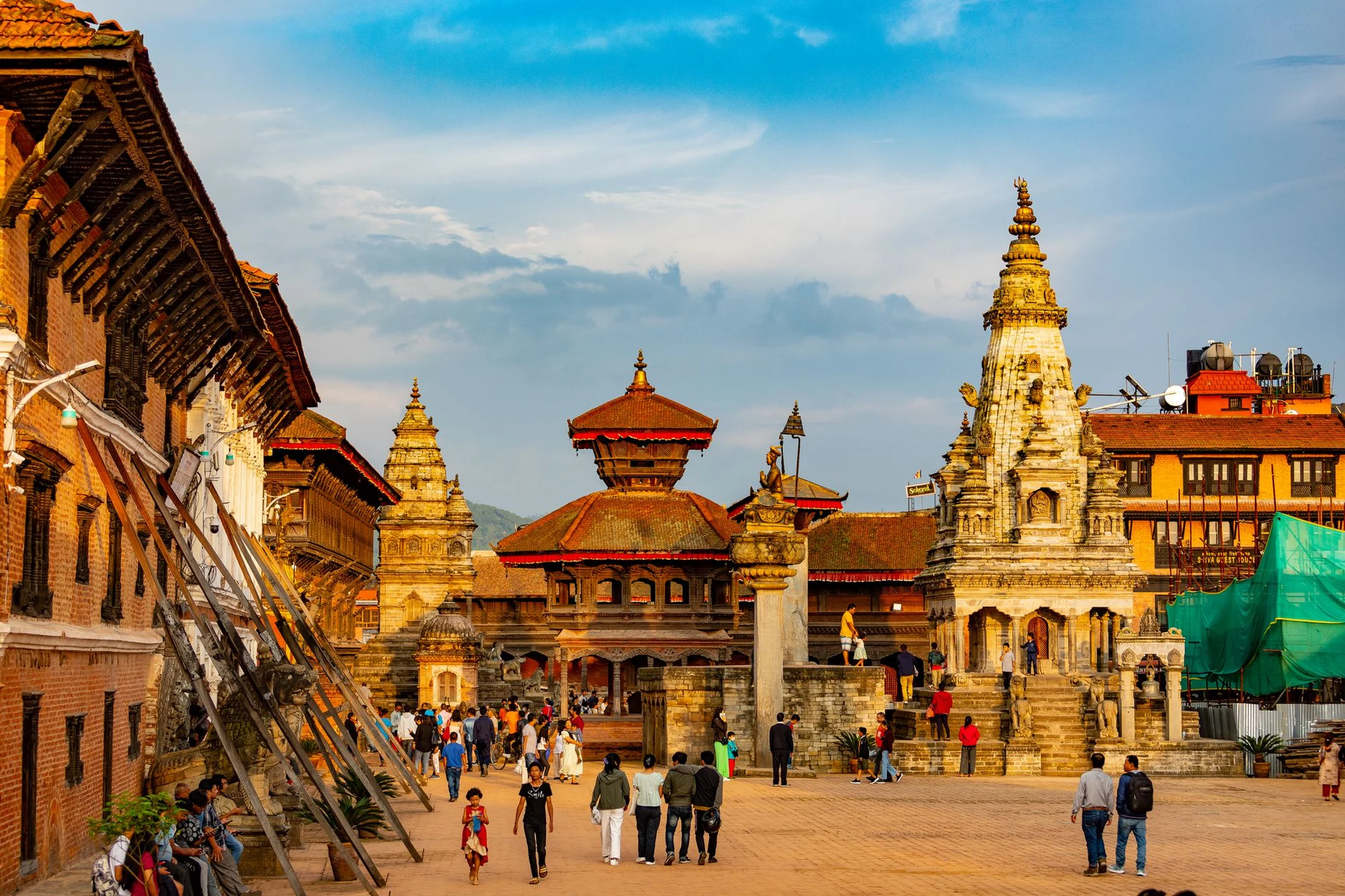
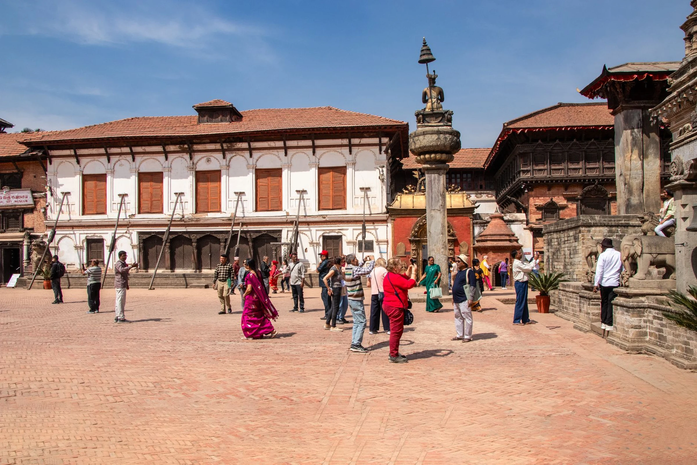
The Kathmandu Valley brings together the capital and historic cities like Patan and Bhaktapur, with temples, squares, and monuments. It is an option for those who prioritize urban life and heritage over trekking days. Bhaktapur also stands out for its pottery and for maintaining the character of an inhabited city; the visit can be planned on foot through its squares, keeping in mind that the place is both a daily space and a cultural destination. For a more focused stop, the guide to Bhaktapur’s Three Squares on a Living Newar Walking Route develops that route.
Mid-mountain: choosing a different scale
Pokhara appears as a reference for the hills and as a point associated with Annapurna landscapes; the Annapurna region, in the west, offers trekking routes of varying duration. Do not turn that geographic proximity into a promise of easy transfer: check connections, times, and conditions on your chosen dates. If you want mountain without setting altitude gain as an automatic goal, compare the options and available time before deciding. The Kathmandu Valley and Pokhara allow different approaches, but available evidence does not allow fixing a universal duration to combine them.
Trekking: the effort depends on the route
In Nepal, there are walks for different levels of experience and physical condition, but that variety does not make routes interchangeable. Frequently traveled paths may pass through villages and teahouses, which offer points to rest; longer routes or those with high passes require greater endurance. Altitude and relief are a substantial part of the decision, not details to be resolved once on the move. Before leaving, confirm permit requirements and access for the chosen route, and leave room to rest or change plans. Rules and fees cited in guides may vary, so do not assume they are current without a recent check.
Lumbini and the south: a journey of different meaning
Lumbini, in the southern lowlands, is associated with the birth of Gautama Buddha and attracts visitors for its religious significance. If the main motivation is cultural or spiritual, it may make more sense to organize the visit around that place than to add it as a quick stop on a mountain route. The guide to Lumbini’s Sacred Garden and Monasteries offers context to distinguish its archaeological, devotional, and monastic spaces.
What to confirm before closing the itinerary
Nepal is mountainous and has no coast; therefore, a route is not organized as a continuous journey along the sea, but according to regions, relief, and connections. Before fixing nights or links, verify transport, availability, and local conditions for each segment. In trekking, confirm the requirements applicable to the specific route: not all share the same rules. The registered language for the country is Nepali and the currency is the Nepali rupee; these are useful references for preparing inquiries, not substitutes for up-to-date practical information. A plan with margin helps avoid forcing stages when access or rest alters the plan.
Sources and references
Hide references
14 references
References consulted during editorial review. Times, requirements and advisories may change: always confirm with the official source.
-
AnnapurnaLicence: CC BY-SA 4.0 Wikivoyage contributors · Annapurna
-
Himalayas (Nepal)Licence: CC BY-SA 4.0 Wikivoyage contributors · Himalayas (Nepal)
-
NepalLicence: CC BY-SA 4.0 Wikivoyage contributors · Nepal
-
Trekking in NepalLicence: CC BY-SA 4.0 Wikivoyage contributors · Trekking in Nepal
-
Bután - WikiviajesLicence: CC BY-SA 4.0 Wikivoyage contributors · Bután - Wikiviajes
-
Nepal - WikiviajesLicence: CC BY-SA 4.0 Wikivoyage contributors · Nepal - Wikiviajes
-
Katmandú - WikiviajesLicence: CC BY-SA 4.0 Wikivoyage contributors · Katmandú - Wikiviajes
-
Bandipur (Nepal)Licence: CC BY-SA 4.0 Fuente: Wikivoyage
-
NepalLicence: CC BY-SA 3.0 DBpedia
-
Village development committee (Nepal)Licence: CC BY-SA 3.0 DBpedia