Three Stops in Togo to Help Plan Your Route
Togo is best explored with distances and regional contrasts in mind: Lomé and the coast in the south, central hills, and the cultural landscape of Koutammakou in the north. Each stop calls for different checks before you settle on a route.
Lomé is a starting point, not a measure of the whole country
The capital and largest city lies on the southern coast, beside the Gulf of Guinea. Togo also includes central areas of hills and forests, and a northern region associated with the Kabye people. Lomé can help orient a first itinerary, but coastal experiences should not be taken as representative of the whole country.
French and the West African CFA franc (XOF) are useful starting points for your research. They do not answer every practical question: check payment options, entry requirements and the services you need before travelling.
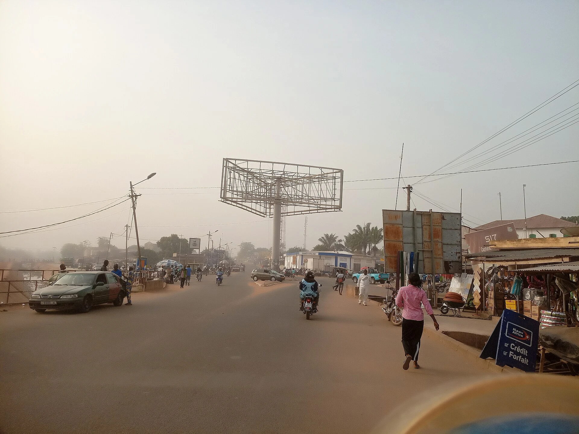
The centre: Kpalimé and the hills
Kpalimé is described as an elevated market town and a base for exploring Mount Agou, identified in the source as the country’s highest point. Together, these make the central region a contrast to the coast. The guide consulted mentions a road journey from Lomé, but check the travel time and road conditions before planning a connection.
Kpalimé is also associated with crafts, including wood carvings, textiles, pottery and other works. If crafts are a priority, confirm which workshops and shops are still operating, and ask before photographing people or their workplaces.
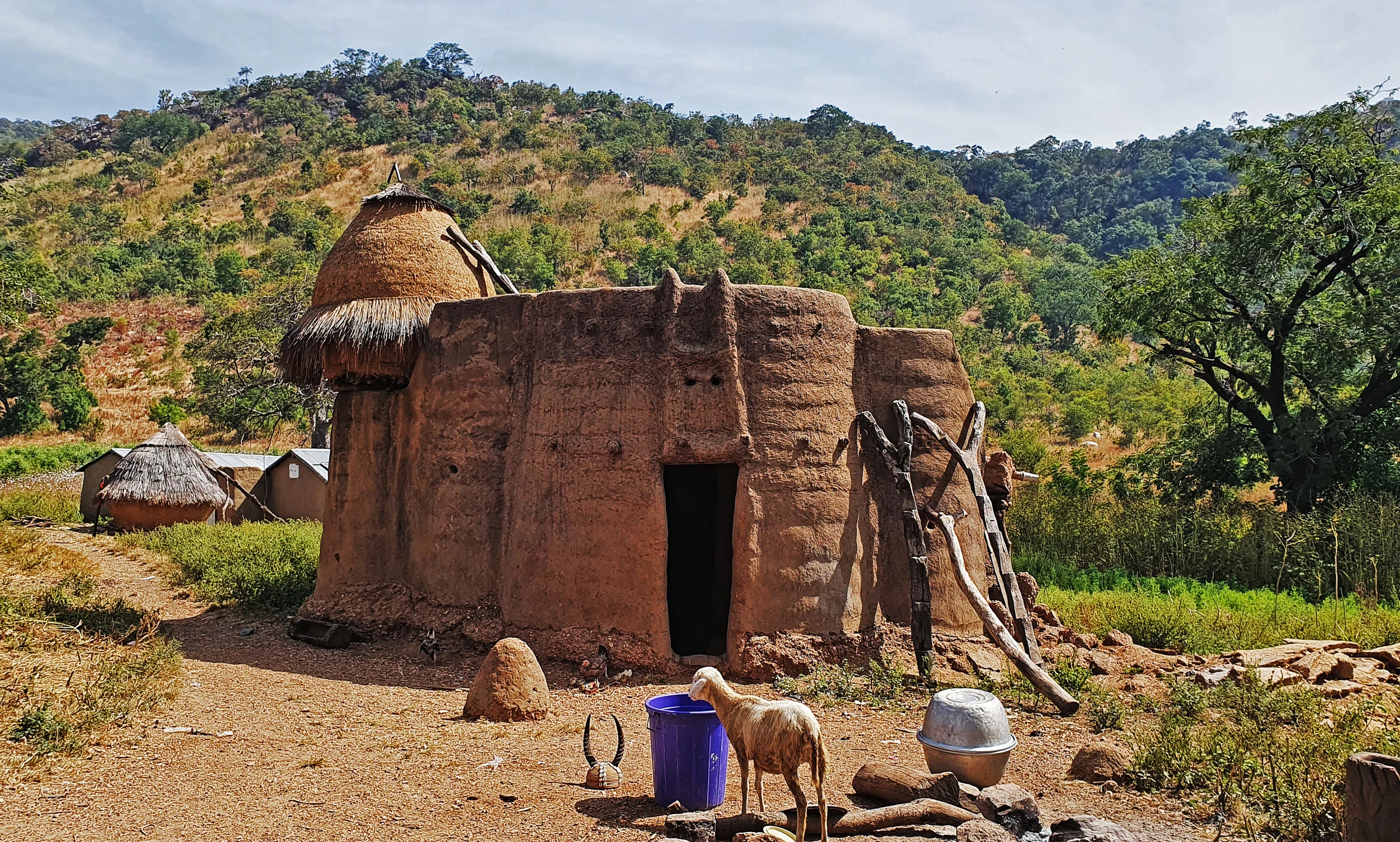
Koutammakou: architecture that is still home
In the north, Koutammakou is a cultural landscape inhabited by Batammariba communities. Its takienta—earthen tower-shaped houses—are homes and cultural symbols, not backdrops detached from everyday life. The region is known for the relationship between architecture, spiritual practices and the environment.
A respectful visit starts with remembering that these are homes and places of significance to their residents: do not enter or take photographs without permission. Available travel information identifies Kara as a reference point for access and mentions settlements such as Nadoba and Koutougou. Check current sources to establish whether the journey is feasible, what transport is available and how visits are organised. Security conditions can change, so do not finalise plans for the north without checking current advisories.
History helps explain today’s borders
After the First World War, the colonial territory of Togoland was divided between British and French administrations. After the Second World War, these territories became part of the United Nations trust system: the British-administered area voted to join the Gold Coast, which became Ghana, while the French-administered area followed a different political course. Togo gained independence from France in 1960.
This history helps explain why present-day Togo borders Ghana and why cross-border journeys need their own planning. Do not treat historical transport information as a description of current services: check routes, border requirements and official advisories before travelling.
Choose your scope and check what can change
Distances and regional contrasts make it sensible to choose a few stops rather than assume that the coast, centre and north fit into one short trip. If cultural architecture is your priority, make a separate decision about Koutammakou based on access and current conditions. For a trip combining Lomé and Kpalimé, check road connections in advance.
The information consulted mentions flights to Lomé and overland routes from neighbouring countries, but does not confirm current schedules, availability or conditions. Check these details, as well as visa requirements and travel advisories, with the relevant official sources before buying tickets.
Sources and references
Hide references
14 references
References consulted during editorial review. Times, requirements and advisories may change: always confirm with the official source.
-
TogoLicence: CC BY-SA 4.0 Wikivoyage contributors · Togo
-
YurihamaLicence: CC BY-SA 4.0 Wikivoyage contributors · Yurihama
-
KpalimeLicence: CC BY-SA 4.0 Wikivoyage contributors · Kpalime
-
KoutammakouLicence: CC BY-SA 4.0 Wikivoyage contributors · Koutammakou
-
Ghana - WikiviajesLicence: CC BY-SA 4.0 Wikivoyage contributors · Ghana - Wikiviajes
-
Benín - WikiviajesLicence: CC BY-SA 4.0 Wikivoyage contributors · Benín - Wikiviajes
-
Burkina Faso - WikiviajesLicence: CC BY-SA 4.0 Wikivoyage contributors · Burkina Faso - Wikiviajes
-
Togo - WikiviajesLicence: CC BY-SA 4.0 Wikivoyage contributors · Togo - Wikiviajes
-
LoméLicence: CC BY-SA 4.0 Fuente: Wikivoyage
-
TogoLicence: CC BY-SA 3.0 DBpedia